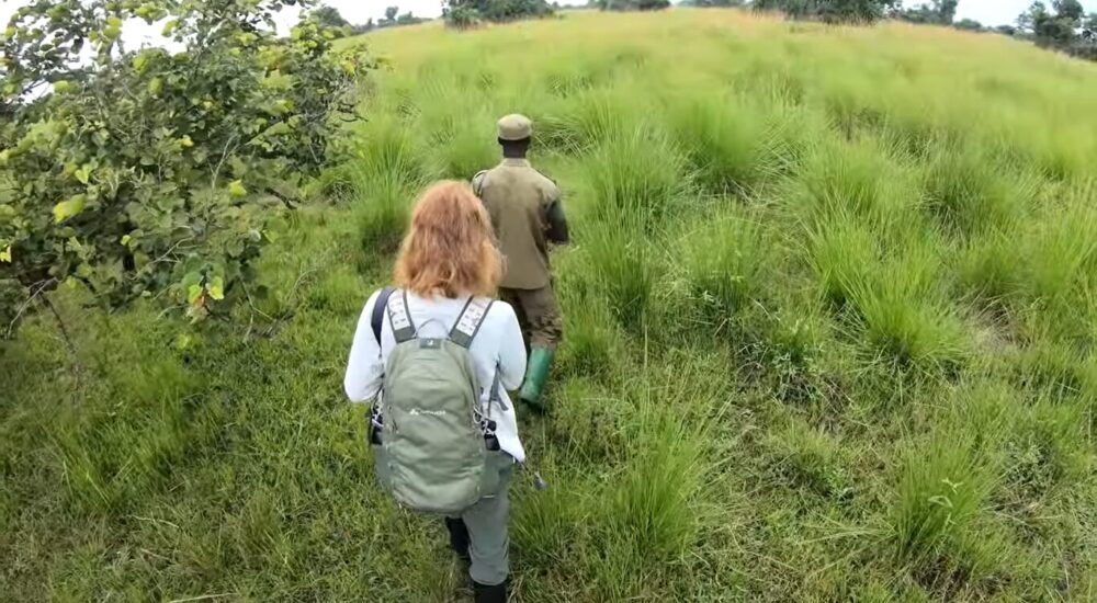
Uganda, famously known as the Pearl of Africa, offers a diverse range of safari experiences,…
Margherita Peak in the Rwenzori Mountains
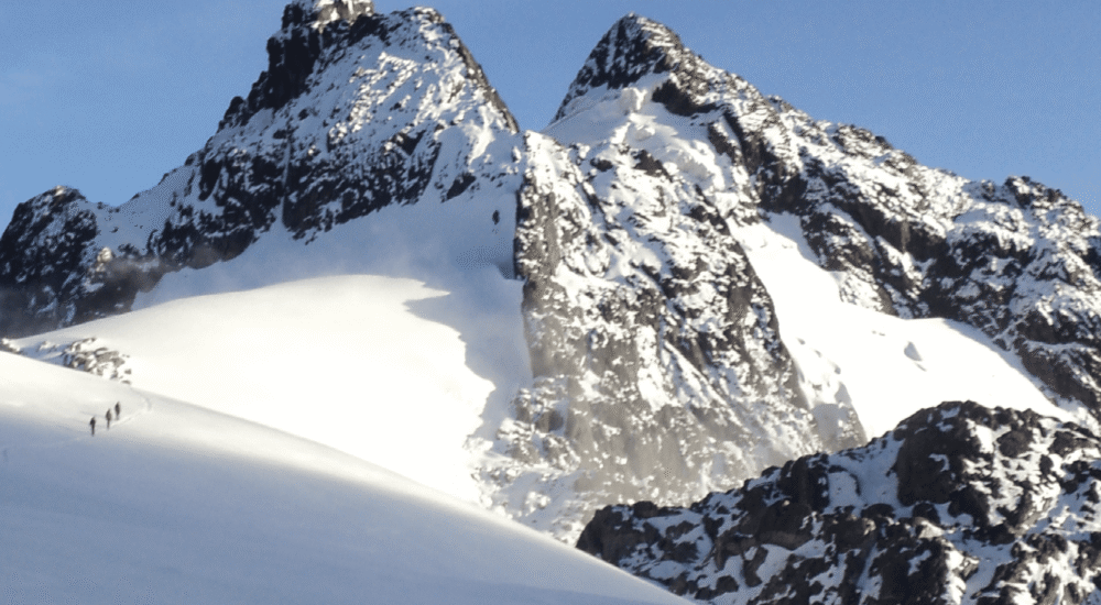
Margherita Peak in the Rwenzori Mountains, One of the most exciting mountain areas to climb is the Rwenzori Mountains. You can’t believe how many different kinds of scenery, plants, and walking paths there are. When you’re holding on to your ice axe and rope as you climb up 60% grades with icicles and snow all around you, it’s easy to forget that you’re in Africa.
The third highest point in Africa is Margherita Peak, which is on Mount Stanley in the Rwenzori Mountains. It stretches from the middle of Lake Albert in the north to the border between Congo and Uganda in the south. This mountain is the third biggest in Africa, after Mount Kilimanjaro and Mount Kenya. It takes 6 to 8 days to get to the top.
The Margherita Peak in the Rwenzori Mountains is named after Queen Margherita of Italy. It was first climbed by a group of people led by Luigi Amedeo Abruzzi in 1906. They were the Duke of Abruzzi, J. Petigax, C. Ollier, and J. Brocherel. The high-altitude Rwenzori loop starts in the dense woods at the edge and goes up high above the clouds to the glacier top of Margherita. It starts at the Margherita peak in the Rwenzori Mountains.
Going past Africa’s huge ice cover, the climb continues up to the rock scramble to the top of Mount Stanley, which is Africa’s third-highest mountain in the Rwenzori ranges and Uganda’s highest peak. Pioneers used the path that goes through Elena Hut many years ago, and now more people use it. As a result of global warming over the past few decades, the glaciers in the Rwenzori mountains are quickly receding. This makes them interesting to see.
Getting to the top of Rwenzori Mountains’ Margherita Peak
There are two main types of hiking trails in the Rwenzori Mountains: those that are high up and those that are low down. Low-altitude hikes usually last three to four days and go up to an altitude of about 3,100 meters. Hikes at high mountains last between 5 and 12 days and reach peaks at least 4,600 meters above sea level.
In order to reach the top of Margherita Peak, you will have to spend at least seven days in the woods. You can get to a fork in the road by going up the hill past Elena Hut and the outhouse. In the Democratic Republic of the Congo (DRC), you can get to the top of this climb from the Moraine Hut. However, this path is often blocked at the last minute because of the unstable political situation in the area.
From this point, there are several ways to get to the Stanley Plateau. One option is to go straight up cracks and fissures, going west through a line of steep rocks to reach the hills above that are less steep. Going south from the small pond leads to the steep cliffs of Kitasamba and the Coronation Glacier. After a short time, the path makes a sharp westward turn and goes up slabs toward the Rwenzoris glaciers.
Climb up steep snow or ice to get to the Stanley Plateau, which is just northwest of this road and has more gentle slopes. The weather makes it hard to see from the top; most of the area northwest of the Stanley Plateau is covered in thick fog. Alexandra Peak is the one on the left if you can see the peaks ahead of you. The beautiful Afro-Montane forest is below, and there is a constant waterfall crashing over the rocks below.
How to get ready to climb the Rwenzori Mountains’ Margherita Peak?
To get to the top of Margherita Peak, you have to go through ice tunnels, over rocks, and up steep slopes that are 60% steep. The majority of people think it’s harder than Kilimanjaro, so you should be in good shape and have climbed mountains before. Recently, the walk to Margherita Peak was named a tough climb. However, this only applies to the last day, when you reach the top. A trained climbing crew will lead you and give you all the gear you need, except for the crampons, which you will need to bring with you.
Margherita Peak in the Rwenzori Mountains Number of People in the Group
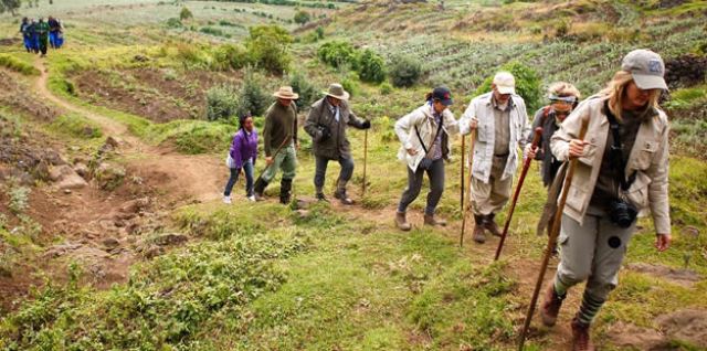
We offer walks for both groups and individuals. You can choose any day, and the number of other people in the group will depend on how many other people planned to be in the woods on that day. The trip will be a private tour if no one else has booked the same times as you. For high-altitude hikes, the largest group size is 8 or 9 people. For low-altitude walks, the largest group size is 15.
Renting Gear for Hiking
When it comes to both gear and exercise, the Rwenzoris have very high standards. Even when there aren’t many tourists, the staff is always in the woods looking for new routes and keeping old ones in good shape. This way, the routes don’t get boring. Working with the best workers in the area who put safety first is important to us.
Trainers from outside the area are brought in to keep the local guides up to date on mountain techniques and safety. Everything that is used for difficult tasks comes from the UK. This includes ropes, ice screws, ice axes, harnesses, and crampons. We’d rather have each customer bring their own crampons, but you can rent some if you need to.
Every trip to the top of Margherita Mountain comes with harnesses, caribinas, ice tools, helmets, rubber boots, ropes, and ice screws. On the one day that you climb Margherita Peak, you only need to know how to do technical climbing. You will need crampons, ice axes, and other expert gear to get across the Stanley Plateau.
This is where the Margherita ice climb starts. The slope is about 60% and changes quickly. Before you reach the top, you have to do a lot of tough rock scrambling. The trip to the top and back to Hunwick’s camp takes about 7 to 10 hours. But if they aren’t in good shape, some people could take up to 16 hours.
To summit Margherita, you need to be very fit and have probably tried to climb a high mountain before. We have a 98% success rate on walks to the top of Margherita Peak. Even though it’s best to have some experience, most of our guests have never used crampons or ice axes before. But our local guides are experts, and if you’re in great shape and determined, you should have no problem getting to the snowy summits of the Rwenzori!
Different Rwenzori Mountain Peaks
Emin
Emin, which is in the Rwenzori Mountains, was named for the traveler Mohamed Emin Pasha, who lived in central Africa. The tough mountain with narrow, steep slopes is ranked fourth in the Rwenzori range and sixth in Africa, even though it doesn’t snow. The second highest point in the Democratic Republic of the Congo is Mount Emin. It is close to the border with Uganda. In the Democratic Republic of the Congo, it is the third-highest peak.
It is part of the Ruwenzori mountain range, which has six peaks. People named the peak after a German doctor named Mohammed Emin Pasha. While doing study in Central Africa, he is known for spreading scientific and geographical information about the area. There are very few and very sharp peaks on the mountain. On the lower area of the mountain, people from Zaire and Mutsori live and work as guides.
The mountain has two peaks: Umberto (1574 feet) and Kraepelin (15,720 feet). Both are between the borders of Uganda and Congo, which makes it easy to get to from the Congo side. This mountain in the Rwenzori Mountains National Park is usually climbed from the southwest of the Ridge, which is easy to get to from the Mugusu Valley, which goes into Congo. The climb then continues through the grassy, steep descent to the path between the two peaks, and finally to the summit.
The park includes this area, which has been a UNESCO World Heritage Site since 1994. This place is in the northern part of the triangle made by Stanley, Speke, and Baker mountains. This place is in the northern part of the triangle made by Stanley, Speke, and Baker mountains. In 1906, Luis Amadeo de Saboya was the first person from Monta Vista to reach the top of the mountain. He has already reached the tops of the other mountains in the Ruwenzori range.
Giant Mountain
It is in the northern part of Mount Stanley, Speke, and Mount Baker, close to Mount Emin. It was named after an Italian explorer named Romulo Gessi, whose peak it is. In the Rwenzori Mountains National Park, the mountain is split in half by a small valley. It is home to the twin peaks of Lolanda (15,470 feet) and Bottego (15,418 feet). With an elevation of 15,018 feet (4,578 meters), Gessi is one of six Rwenzori peaks that make up the Northern Triangle. The other three are Mount Stanley, Baker, and Speke. Also, Gessi is Uganda’s fifth-tallest peak. It lies along a short canyon that goes south from Mount Emin.
The mountains are also rocky and run north to south, with the highest point looking south. On both the Democratic Republic of the Congo and Ugandan parts of Mount Gessi, the way is marked by huts and sloped paths. A short path leads from Mutsori in the Congo to the top of Gessi. Most of the men from the local tribes are always there to help with the hike and act as porters and guides. Along the Rwenzori, many shanties have been kept alive.
The Mount Stanley
The Rwenzori Mountains National Park is home to Mount Stanley, which is 5,109 meters high. The Democratic Republic of the Congo and Uganda both have the largest peaks there. Mountain Stanley is in the Rwenzori range. With a height of 5,109 meters, it is the tallest mountain in both the Democratic Republic of the Congo and Uganda (16,763 feet).
It is also the third tallest mountain in Africa, after Mount Kenya (5,199 meters) and Mount Kilimanjaro (5,895 meters). A lot of the peaks in this area are high enough for glaciers to live on. Sir Henry Morton Stanley was an author and explorer, and this rock is named after him. This mountain is in the Rwenzori Mountains National Park, which is a UNESCO World Heritage Site.
Mount Stanley is also made up of a high chain of 11 peaks that rise from glaciers. The Stanley Plateau, which is about a kilometer long and is the longest piece of ice in the Rwenzori Mountains, is part of this chain. You can walk from the Elena hut to the first rocks to get to Margherita, the highest peak. After that, the road goes across the snow-covered Stanley Plateau to reach Alexandra Top, which is the second-highest peak in the Massif.
The most common way to get to the top of Margherita Peak is to go up a steep valley on the eastern side of the summit and then climb the beautiful Margherita glacier to the saddle between the Margherita and Alexandra summits. Keep going north until you reach a high, narrow rock wall that leads to the top.
For the steep climb, you will need a rope for both the badly cracked glacier and the summit rocks. An added benefit is that the peak forms a natural line between Uganda and the DRC. The eastern narrow top of Alexandra top, which is 4990 meters high, is also a great treat for mountain walkers. At 4977 meters, Savoia Peak connects to a different mountain group to the south.
Mount Baker
The Rwenzori Mountains National Park in Uganda is home to Mount Baker. Three miles away, on the other side of the border, is the Democratic Republic of the Congo. At 4,844 meters (15,892 feet), the peak, which the locals call “Kiyanja,” is Africa’s sixth-highest mountain. There is a triangle shape in the upper Bujuku Valley made up of Mount Speke, Mount Stanley, and Mount Stanley.
The closest peak is Mount Stanley, which is 2.26 kilometers (1.40 mi) to the west. The mountains are in a place called “The Mountains of the Moon.” There are several high points on Mount Baker and all the peaks in the Rwenzori Mountain Range. Edward Peak is the biggest of these.
Austrian climber Rubert Grauer went to the top of Mount Baker in January 1906 with two British preachers, H. W. Tegart Addox and H. E. M. From February to April, an English expedition led by A. B. Wosnam, Alexander F. R. Wollaston, and M. Carruthers looked into the same rock-strewn area. A group led by the Duke of Abruzzi reached the top of Mount Baker in June 1906.
This group walked to the tops of the last five highest peaks in the Rwenzori. Franz Stuhlmann found the peak while on an expedition into the Ruwenzori in June 1891. He called it either Ngemwimbi or Semper. In 1864, Samuel Baker was the first person from Europe to see Lake Albert in the Rwenzori Mountains. This made Abruzzi want to name the peak after him.
Mount Speke
The second-highest rock in the park is Mount Speke, which is in the Rwenzori Mountains National Park. The upper Bujuku Valley is surrounded by a triangle made up of Mount Baker and Mount Stanley. The distance between Mount Stanley and the center of the world is 3.55 kilometers (2.21 miles). The Mountains of the Moon area is where these mountains are. All of the mountains in this group have rough tops. Vistioro Emanuele (4,890 meters; 16,040 feet), Ensonga (4,865 meters; 15,961 feet), Johnston (4,834 meters; 15,860 feet), and Trident 4,572 meters are some of Mount Speke’s 15,000-foot peaks.
The names came from an Italian royal line, but the British Protectorate of Uganda, which was in charge of the area at the time, insisted that they be recognized. Europeans first came to the area to look for the source of the Nile.
They named this hill John Speke. Speke drew the source of the White Nile in 1862, even though he had never been to this peak. These mountain ranges were all named after related travelers who came to Africa in the early days of colonization. Because it rains so often, Mount Speke is cut through by many streams and rivers, and the plants that grow there look thick.
Up on Mount Luigi di Savoia
The Rwenzori Mountains National Park is home to Mount Luigi di Savoia, a Rwenzori Mountain. Its highest point, “Sella,” is 4637 feet, making it the fourth highest in Uganda and the sixth highest in Africa. No matter what its name is, Mount Luigi is the only peak in the Rwenzori range that the Duke of Abruzzi did not try to climb.
Like the other Rwenzori mountains, Mount Luigi Di Savoia has a long slope with many peaks. Some of these are Stairs Peak (4545 m), Sella Peak (4627 m), and Weismann Peak (4620 m). From the Fresh Field Pass area, it is easier to climb the northern face of Sella Peak to the top.
There you have it. The Rwenzori Mountains are one of the most exciting mountain areas to climb. You can’t believe how many different kinds of scenery, plants, and walking paths there are. When you’re holding on to your ice axe and rope as you climb up 60% grades with icicles and snow all around you, it’s easy to forget that you’re in Africa.
Related Posts