Introduction Mount Elgon National Park, located on the border between Kenya and Uganda, is one…
Mountains of Uganda | Mountains Found in Uganda
Is there a mountain range in Uganda? There are various mountains in Uganda that provide animal watching, mountain climbing, and trekking options to visitors on Uganda adventure safaris. Uganda’s mountains include the following: Mountains of Uganda | Mountains Found in Uganda
The Kigezi area, located on the western branch of the Great East Africa Rift Valley/Albertine Rift, is Uganda’s most hilly region. The terraced farms in the mountains of the Kigezi district give Uganda its characteristic aspect. Kigezi is known as the “Switzerland of Africa.”
Bwindi Impenetrable National Park, located in the highest regions of the Kigezi highlands on the border of the western Rift Valley, is home to about half (459) of the world’s population (1063) of mountain gorillas.
Rwenzori Mountains
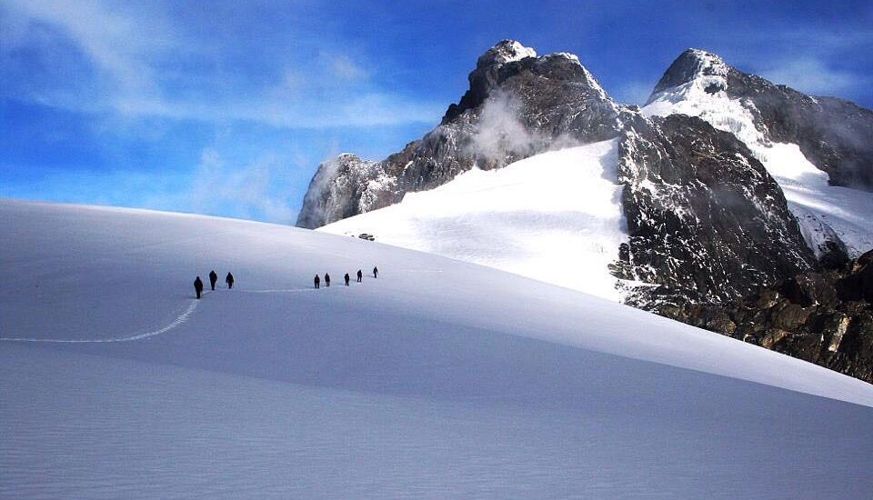
The Rwenzori Mountains, popularly known as the “Mountains of the Moon,” are a kind of block mountain. It is located north of Kigezi on the border of Uganda and the Democratic Republic of the Congo within the Rwenzori Mountains National Park, a UNESCO World Heritage Site and a popular location for African mountain climbing safaris.
Claudius Ptolemy, the Greco-Roman mathematician, astronomer, and founder of geography, recognized the Rwenzori Mountains as the source of the Nile in 150 AD, dubbing them “Mountains of the Moon” because their snow-covered peaks on the sweltering equator seemed otherworldly.
The Rwenzori mountain range is 120 kilometers long and 65 km broad. The mountain range is divided into six massifs by deep canyons.
Margherita Peak on Mount Stanley in the Rwenzori range is the third highest point in Africa, behind Uhuru Peak on Mount Kilimanjaro in Tanzania at 5,895 meters and Batian Peak on Mount Kenya in Kenya at 5,199 meters.
Peaks on the Rwenzori mountains
Mount Speke at 4,890 metres
Mount Baker at 4,843 metres
Mount Emin at 4,798 metres
Mount Gessi at 4,715 metres and
Mount Luigi di Savoia at 4,627 metres
Virunga volcanoes
Mgahinga Gorilla National Park is located on Uganda’s border with Rwanda and the Democratic Republic of the Congo, just a few kilometers south of Bwindi Impenetrable National Park. They also have mountain gorillas and are an excellent place to go for gorilla trekking in Uganda, as well as mountain climbing and hiking.
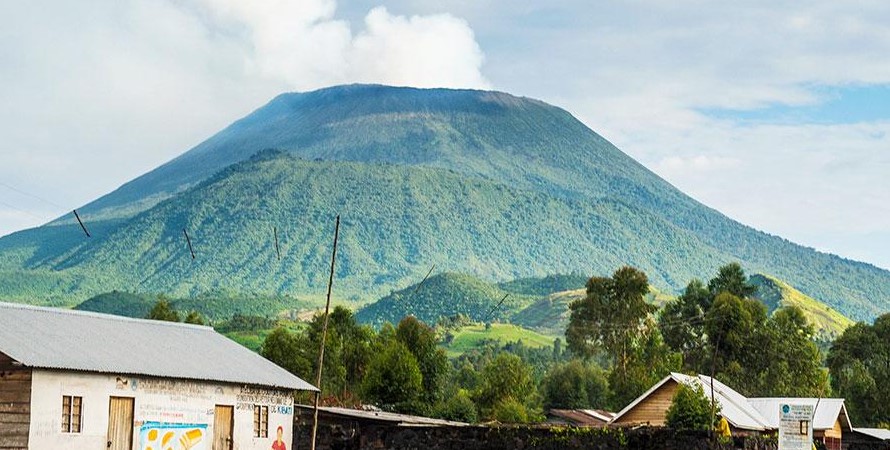
The Virunga volcanoes in Uganda are an extension of a chain of eight volcanoes in Rwanda, Congo, and Uganda. The name “Virunga” comes from the Kinyarwanda term ibirunga, which means “volcanoes.” Except for Mount Nyiragongo and Mount Nyamulagira in the Democratic Republic of the Congo, most of them are inactive.
The Virunga Volcanoes in Uganda
Mount Gahinga (3,474 meters)
Mount Sabinyo (3,674 meters)
Mount Muhabura (4,127 meters)
Mount Elgon
Mount Elgon, also known as Masaba, is an extinct shield volcano in eastern Uganda near the Kenyan border. Elgon is also East Africa’s oldest and largest isolated volcanic peak, thought to have erupted around 24 million years ago and last erupted 10 million years ago.
At 4,321m (14,177 ft) above sea level, it is the second-highest peak in Uganda and the eighth-highest mountain in Africa. The Mount in Uganda is made up of four significant peaks:
Wagagai, the highest peak at 4,321 meters
Sudek peak at 4,302 metres on the Uganda/Kenya
Mubiyi peak at 4,211 metres and
Masaba peak at 4,161 metres
Mount Elgon also has the following significant features:
The crater Mount contains one of the world’s largest preserved calderas encompassing more than 40km2 on its summit.
Mt Elgon also possesses the world’s biggest base of any extinct volcano.
Mount Elgon is also the name of Uganda’s Mount Elgon National Park, which is a popular site for mountain trekking and climbing safaris.
Other significant mountains in Uganda include:
Mount Moroto (3084 meters)
Mount Kadam (3068 meters)
Mount Morungole (2,750 meters)


